| Home | | | Back |
| Corregidor photos .. 1956 |
| Images and narrative from Dick Carlson |
| Please scroll-down for full collection of photos and narrative. |
|
|
One of the greatest and proudest moments in my 20
years in the SecGru was going TAD out of Kami
Seya on aircraft carriers. I begged, pleaded, cajoled, & bribed anyone in authority to let me go. After weeks of this, orders arrived. I left Kami Seya in early December 1955 in wet and dreary weather, to board a Navy flight out of Atsugi NAS for Naha, Okinawa. We were treated to a grand view from the air of snow capped Mt. Fuji. Our flight arrived in just a few hours to somewhat warm and humid weather. I loved it!! The island is some 67 miles in length and 3-12 miles in width. My knowledge of the history of the island was somewhat limited, but I did know, from high school history, that the island’s expansion by the Chinese occurred somewhere around 605 and 606 AD, and that Commodore Matthew C. Perry visited and landed at Naha Port in 1853, purchasing land for a coal station. I had hoped for a few days to do some exploring and photographing the area before my carrier arrived. Alas there it was, anchored out on a sea of blue water. It looked great! A navy boat ferried me out to my ship, and on December 2nd, I reported aboard the USS Bennington CVA20. I was now going to be a sea-going sailor, and I for one, was looking forward to this grand experience. It would give me a greater appreciation for those who sail our ships in foreign waters. I was to make a host of new friendships with men from around the USA. If nothing else, it would certainly fill up volumes of pages to the folks back home and triple the slide library I was building. At some point in time, I’ll write more of this experience.
Working for ComCarDivOne (Rear Admiral T. B.
Williamson) was an amazing experience for me. He
was a fair
Rear Admiral Williams very often took his staff, of
which the detachment was a part of, to various
places of |
 |
|
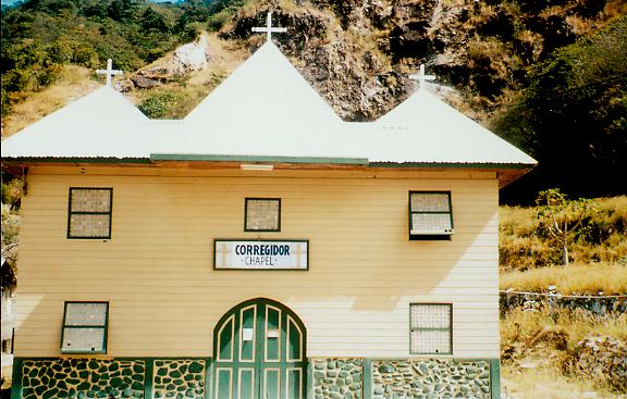
Waiting for us at the dock, were tarpaulin-covered
trucks into which we would ride to the top of the island. The only building I saw at the docks was the Corregidor Chapel. |
 |
|
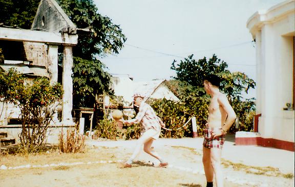
A fast game of volleyball ensued. I cannot identify
these folks. I wish I had taken more time to note down names, and take more pictures of the buildings. |
 |
|
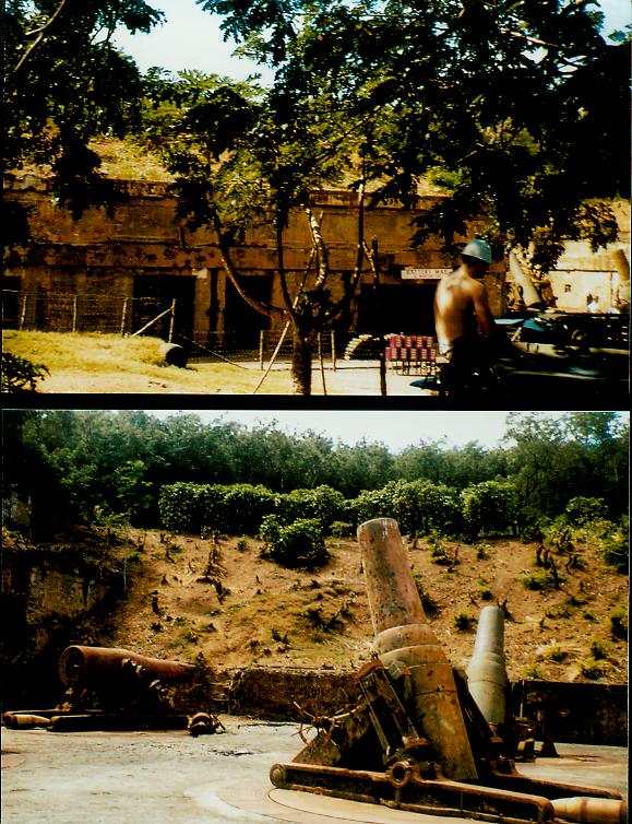
This is BATTERY WAY. The entrance to the tunnels was blocked off with wire fencing. There were no tunnels that I could get into on this visit. We were fairly well restricted to certain areas. Richard Gordon of Burnt Hill, NY who was a defender of Bataan, a survivor of the Death march, Camps O’Donnell and Cabanatuan writes "on Corregidor, there were 15,000 American and Filipino troops, consisting of anti-aircraft and coastal defense, along with the Fourth Marine Regiment, recently arrived from China (December 1941) less a detachment station on Bataan, as part of Naval Battalion." Set in a picturesque grove and surrounded by trees on three sides, Battery Way comprises four 12-inch [305mm] Mortars. Named after Lt. Henry N. Way of the 4th US Artillery, who was, in 1900 a casualty of the 1899 US-Philippine war, these 12-inch mortars are of the M1890 type and are mounted on M1896 Mortar Carriages. They could lob a 1,000 lb deck piercing shell or a 700 lb high explosive shell 8.3 miles (13.35 km) in any direction. The battery's construction was commenced in 1904 and completed 1914 at a cost of $112,969. It was not utilized until the latter part of the siege, at which time it took a critical part in the invasion. Maximum rate of fire was one round each 45 seconds, though this was for crews at the peak of physical perfection, and a one round per minute rate was generally seen as normal. The normal tactic was to load and lay two mortars at a time, and then to fire them as a salvo, giving them a 'shotgun' effect. Each mortar required a fourteen-man crew. When fired pre-war, the Mortars shattered medical glassware in the hospital nearby, so the Battery was not practiced-fired during peacetime. To read more about BATTERY WAY, go here to: http://corregidor.org/chs_rowbotm/way.htm |
 |
|
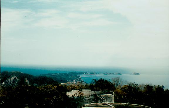
The island is 1,735 acres in total, lies two miles
from the southern tip of Bataan peninsula and seven miles from Cavite Province, dividing the mouth of the Manila Bay into what was called the North Channel and the South Channel. The island is shaped like a tadpole with the head facing the South China Sea and the tail curling back into Manila Bay. I ‘think’ this is a picture, taken from ‘topside’ looking toward the ‘tail’. |
 |
|
The following information is from the booklet "INTERCEPT STATION "C" from Olongapo through the evacuation of Corregidor, 1929-1942" Copyright by the NCVA. It was later reprinted in a special issue of CRYPTOLOG, the quarterly newspaper of NCVA.
"The island is divided into five parts. The high, round head of the island rising to 628 feet in elevation forms an area
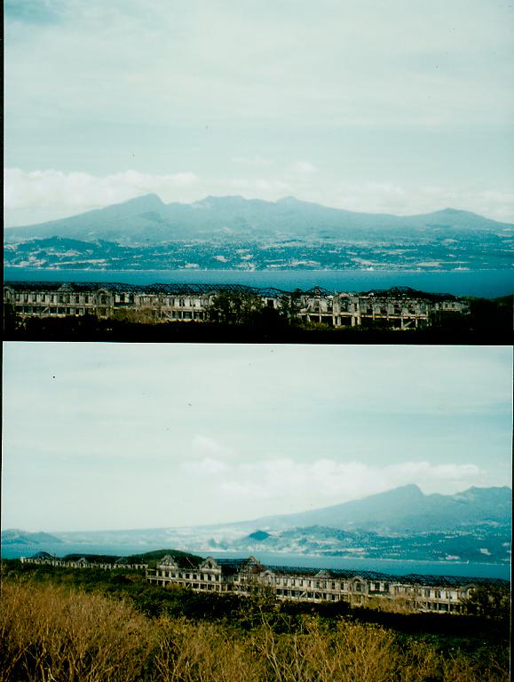
From the many photographs I’ve seen, it appears that this photograph is of the mile-long barracks, with the Bataan To see what it looks like now in 2002, go to: http://www.warofourfathers.com/war/philippines_index.html and click on MILE-LONG BARRACKS. |
 |
|
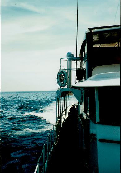
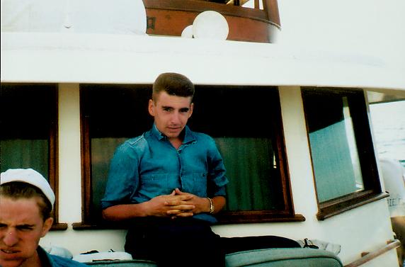
A very sunburned, and tired CTR3 Dick Carlson,
1/56 on the USS Margaret returning to Manila and the USS Bennington CVA 20 after a day on Corregidor, and swimming in some of the secluded bays around the island. The young man in the lower left is CTR3 Wallace Morgan. I was to later meet up with him again at Karamursel, Turkey in 1961. |
| Home | | | Back |