Home | | | Back |
Cape Chiniak, Kodiak, Alaska .. 1963 |
Images from Bob Potratz |
Please scroll-down for the full photo collection. |
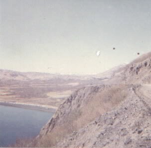
The winding gravel road from the Naval Base to Cape Chiniak was about 38 miles long. It was reportedly built by the 151st Combat Engineers Construction Battalion in 1941-42 to service part of the harbor defenses being constructed at Chiniak, known at that time as Ft. J.H. Smith, to protect the Kodiak Naval Station which had recently been built. The high point of the road was the infamous 'Kalsin Bay Hill'. This was a spot where you rounded a curve, and there below, was Kalsin Bay, perhaps 300 feet below. The road had no guard rails at that time and was probably about the same as it was when constructed 20 years earlier. We arrived in January of '63 when there was considerable ice and snow on the road. This made our first trip to the Cape a very interesting one! The day before we arrived, a Navy P2V-7 plane smashed into the side of what was known as Old Women's Mountain when the pilot aborted a landing. He mistakenly banked to the left. The crash killed seven people and was still smoldering when we arrived the next day from Adak. Kind of made us wonder what we were in for and thankful that the trip from Adak had gone smoothly! |
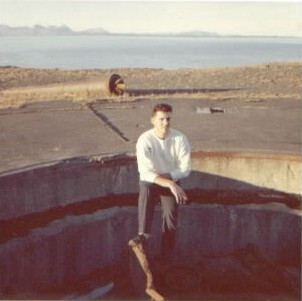
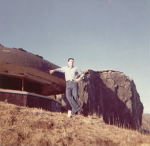
This is a picture of one of the two 8" gun emplacements located at Chiniak. They were part of the WWII harbor defense system of the Kodiak Naval Base and the Army garrison known as Fort Greely. They were originally designed for use on WWI battleships and had been in storage for quite a number of years before being installed here. Special carriages had to be constructed for them which is what I am standing in. The combined weight of the guns and carriage was listed at 103,000 lbs and the range was listed as around 35,000 yards. There were two other 8" guns located across Chiniak Bay at a place called Millers Point, about three or four miles from the town of Kodiak. The guns were never fired at the enemy as the closest attack made by the Japanese was at Dutch Harbor, some 500 miles to the west. The four guns were destroyed by the Army caretakers following the war sometime in late 1948 or early 1949 according to reports. The two at Millers Point are still there and are now part of a Kodiak Military History site. According to Joe Stevens, Kodiak military historian and host of a large and informative website www.kadiak.org dealing with same, the gun in the picture that was at Chiniak is now on display in front of the Bushkin River Inn at the airport. No traces of the second gun at Chiniak existed at the site when I was stationed there in 1963. More info on the guns, who constructed them and when, can be found on Joe Stevens' site. Several letters in his guestbook are from WWII vets who actually helped construct the sites and install the guns (ref letters #'d 5, 28, 29, 36 & 52). |
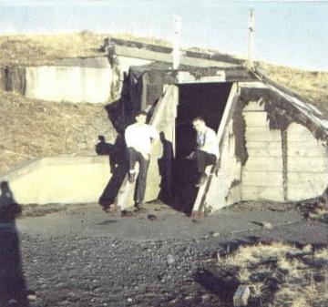
This picture was taken in front of the large two story ready amunition bunker which was between the two 8" gun emplacements at Cape Chiniak. It was contructed in 1942 by members of the 43rd USN Construction Battion (CB'S). The officer in charge was LTjg Wm. F. Blank. More inflormation on this can be found on the website www.kadiak.org (ref. letter #5 in the guestbook section written by Mr. Blank) |
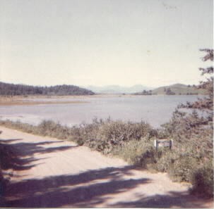
This picture was taken about a mile from our barracks as the road passed by Chiniak Lake. The Naval Station, near the town of Kodiak, was about 38 miles away (by road) at this point. The sign by the road informed any who managed to travel this far that they were now entering a restricted area. The Naval Base and the town of Kodiak lay at the foot of the mountains in the background, some 17-18 miles away across Chiniak Bay. |
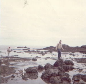
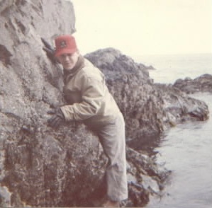
An exploring expedition at the bottom of the cliffs, obviously done at 'low tide'. There would have been at least six or seven feet of water covering this area at high tide! Pictured are Chief Steinmetz and Curt Wilkens who were on the same watch section as I was. |
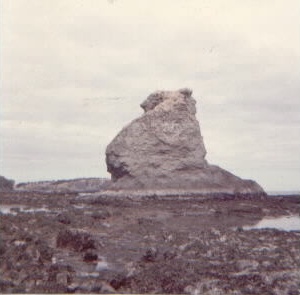
This was an interesting rock formation along the same stretch of coastline. Only one like it in that area. It is very similar to what are known as 'The Twelve Apostles' off the coast of southern Australia that you will see in any Australian travel guide. Haven't seen this one in any Kodiak travel guides! |
Chief Steinmetz hugging the rocks to stay out of the water as the tide was coming back in. We still had several hundred yards to go before we could reach a point where we could scale the cliffs. |
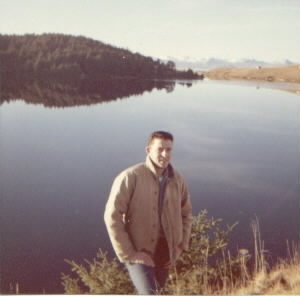
One of those rare clear Kodiak days. Even the wind was still, creating a mirror like suface on Chiniak Lake. |
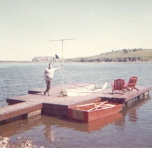
Our boat dock by the cabin on Chiniak Lake. The cabin had been built in '61-'62, a year before I arrived. The Chiniak 'Fleet' was in port that day. |
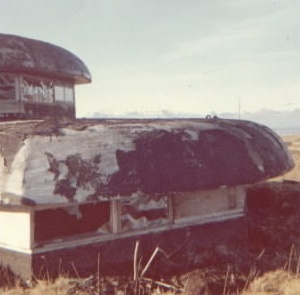
This was the closest bunker to our barracks. It apparently was used as a communications command post. The pictures of the Chiniak coastline were taken very near this spot as it had a commanding view of the ocean and the surrounding area. |
Another of the bunkers on top of the cliffs at the tip of The Cape. This one was only about a half mile from the barracks. |
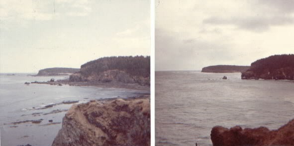
Two photos taken on different days of the rugged coastline. It was only a coincidence that one was taken at low tide and the other at high tide - quite a difference. These shots were taken only about 300 yards from our barracks and immediately behind us was one of the bunkers shown in one of the other pictures. |
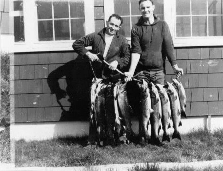
This picture was taken in August during the run of the silver or 'coho' salmon. Don't remember the names of the two holding the stringer of fish, but the taller was one of our cooks. Some of the salmon were smoked in a small building behind our barracks. |
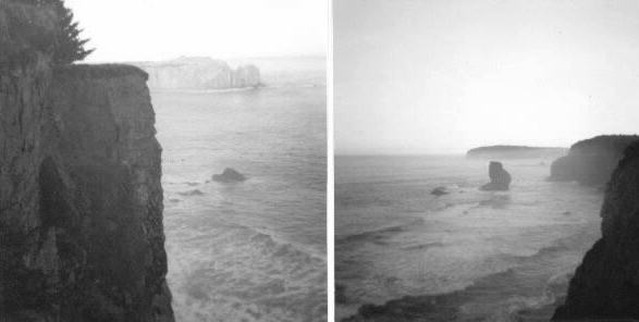
Two black and white shots of the rugged Chiniak coastline taken less than a mile from our barracks. In one or two places, it was a sheer 100' drop to the rocks below. |
Home | | | Back |