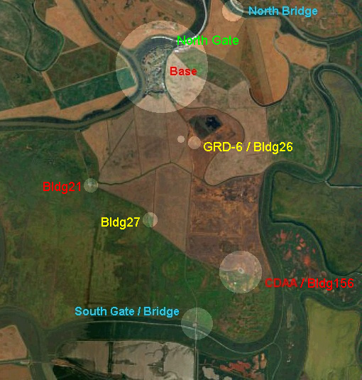
of Skaggs Island.
Click-on each of the highlighted
areas
of the photo.
Please be patient - and a large view
of the same area will be seen in a
'separate' browser window. Please
close the separate browser window
to return to this window.
This aerial photo was taken in 2000 -
therefore some of the things that
we are used to seeing are missing
(i.e. CDAA itself)
Complete Aerial Overview
of Skaggs Island.
Physical Features Map
and Aerial View of Mainside
Skaggs Island.